Day 29 - Mining country and the middle of nowhere
- Paul Juckett

- Jul 6, 2020
- 3 min read
Today I made the long journey to Cape Cornwall with a plan to walk 13.6 miles.
The weather was glorious and I should have been raring to go. As it happens, I was but my legs seemed to take a little longer to persuade!
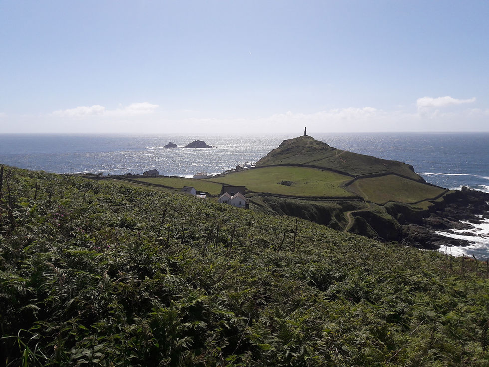
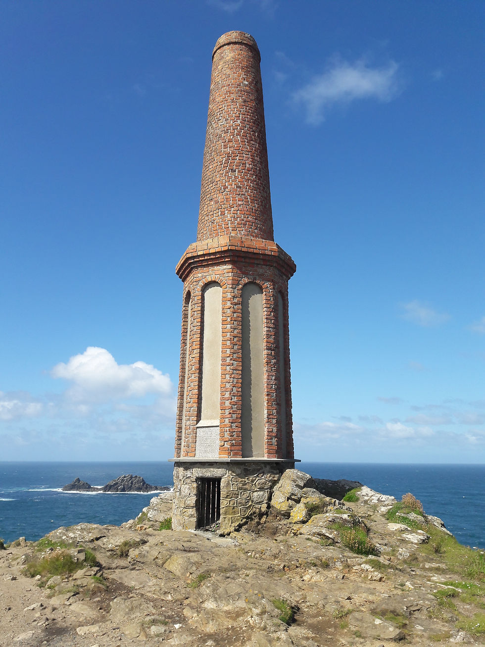
The first challenge was to walk up the 'cape' itself, to the old chimney of Cape Cornwall mine (the picture above shows Cape Cornwall from the head of the Kenidjack Valley. The Picture below is the Chimney from close up.
Today's walk is a bit up and down (it's rated Moderate to Strenuous in places), but the first 4 miles are through the heart of the mining area that used to crowd the North Coast.
The first area of interest is the Kenidjack Valley, where the ruins of the Kenidjack mine spread along the valley floor to the sea. The coast path runs along the Western side of the valley, before plunging down steeply into the valley and then climbing steeply ot of the Eastern side. I didn't have time to really explore, but there was enough visible for me to add this to a list for another visit.
Below is a picture of the main mine engine rooms at the inland head of the valley.


The picture above is taken from the sea end of the valley, showing Cape Cornwall (far right) then mine buildings (centre) and the main engine house (far left).
Once you are out of the valley, the landscape is littered with the ruins of old mines. Several Chimneys and engine houses are passed, before you catch a glimpse of the first ruins of note. These are the much photographed Crowns mine buildings. Perched on the cliff face, far below the path, they can be visited close up (if you have the time and inclination) by walking down a steepish path, but again for me, that would have to be for another day! I did manage to take a photo with the zoom lens on my phone.

Another climb out of the area of Crowns mine (nr. the village of Botallack) brings you to the most complete set of mine ruins in the area. The Levant mine was one of the most successful in the area and the remains of nearly every part of the mining process can be explored and read about on handy information boards. The Levant mine closed in 1930 after an accident in 1919 that killed 31 miners had meant the lower levels of the mine were abandoned, making profitability difficult. The mine ran for 1 mile under the sea!
Some pictures below show various aspects of the mine, it's maintained by the National Trust and is worth a visit if you have an interest in history.

The chimneys and main engine house of Levant mine.

A view across the mine complex.

Levant mine ruins.
Find out more here: https://www.nationaltrust.org.uk/levant-mine-and-beam-engine
Close by is Geevor tin mine, a replica of a working tin mine that can be visited (once the Corona crisis has abated) and provides tours underground.
As you leave Levant mine, the Light House at Pendeen Watch is visible and the path again leads down into a small valley before climbing out to meet the road to the Lighthouse.


After Pendeen Light House, there is a long walk ahead to get to Zennor (about six miles distant) and very little in the way of civilisation. The path skirts around the Cliff tops past Portheras Cove (a fine Sandy Beach, that rewards those who are prepared to walk the mile to get to the access point), before the cliffs become Granite and the path is strewn with granite boulders making walking harder. I walked about two miles of this section, aiming for a spot in the middle of nowhere (more accurately, just passed the village of Morvah, but that doesn't have the same drama about it!).
Upon reaching the intersection of the coast path and a inland footpath I turned back.

I have to be honest, I was glad to get back to the car today, the legs had not been entirely up for it today and I felt the last couple of miles!
Hopefully, the body will be more willing tomorrow when another thirteen mile section of coast path will be tackled!


Comments