Day 40 - Mount's Bay
- Paul Juckett

- Jul 20, 2020
- 3 min read
Today was the first day on this walk that has cost me nothing (well nearly nothing) as I was able to catch a train from Liskeard to Penzance and start my walk from there (little petrol cost and no paking costs!).
The train journey down allowed me to catch up with an ex colleague (Cathy) and get the latest news on my old company until she alighted at Truro, it was good to catch up as COVID has meant we couldn't have our normal Wessex Trains team drinks!
GWR delivered me to my destination on time and after pausing to chat with a few more ex colleagues, I headed off towards Marazion along the footpath.

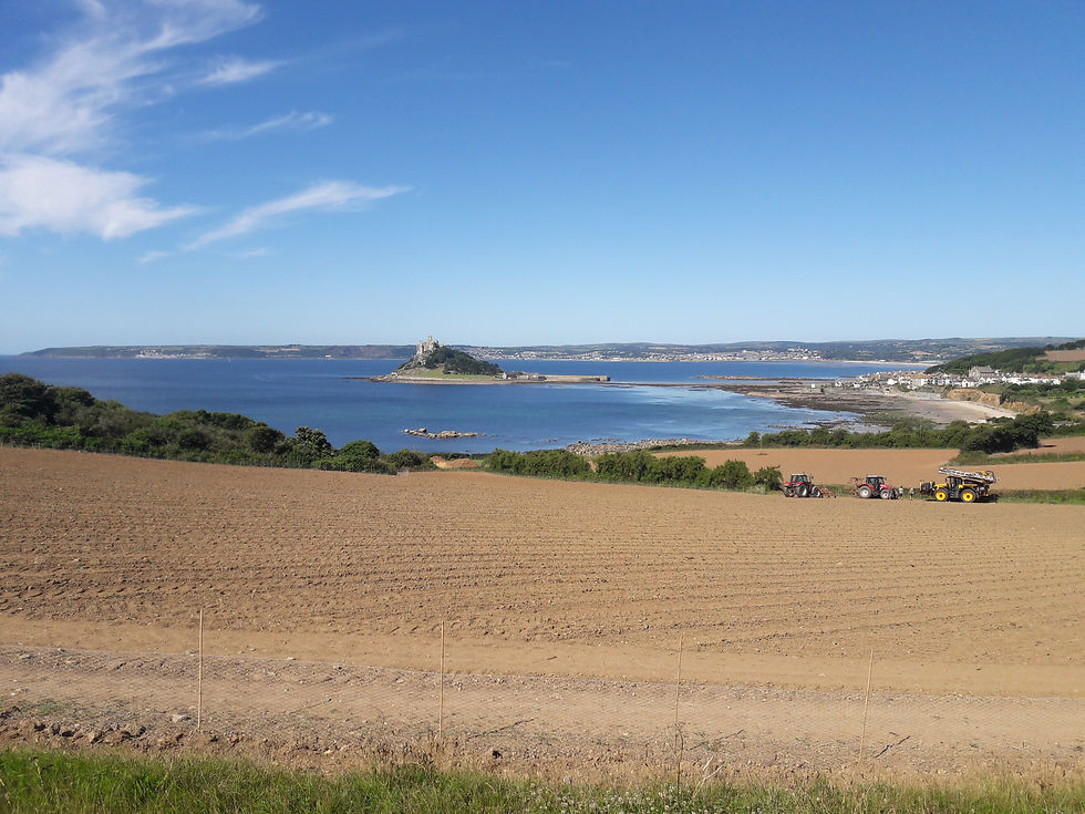
The walk from Penzance to Marazion is around 2.5 miles and the view is dominated by St. Michael's Mount (https://www.stmichaelsmount.co.uk/).
With current restrictions due to COVID-19, you can't just wander over to the mount (all tickets have to be booked in advance on-line), so as much as I was tempted today, I carried on by, making do with the memories I had from my visit with Mum forty plus years ago (I mainly remember it's a steep walk up to the castle!).

There is currently another coast path diversion in operation (albeit a dubious one that looks like it might have become permanent), so you have to walk along the narrow road through Marazion for about a mile and a quarter before the path turns off the right hand side of the road just past the cemetery.
More incredible views of the Mount can be seen form here!

The path stays pretty level right the way round to Perran Sands (where refreshments can be obtained from cafe's or a pub which is highly recommended) before it begins to get a little more up and down as you approach Cudden point.

Approaching Cudden Point, you'll pass Acton Castle sitting on top of the hills.

After Cudden point, you come to several small coves, Piskies Cove (sand and rocks), Bessy's Cove - pictured (rocks with second cove that has a small slipway and several small boats moored - pictured)


The path joins a small road at Bessy's Cove and drops down through the Porth-An-Ells estate, running between the Main House (seaward side) and the Garden Lodge (pictured)

According to Google maps, Prussia Cove is immediately after these two buildings (now holiday lets) down a small path leading off the main path.
Prussia Cove was my intended turning back point today, but I could not find the 'Warspite Pillars'.
HMS Warspite ( https://en.wikipedia.org/wiki/HMS_Warspite_(03) ) was the first ship to open fire on the beaches of Normandy at H hour on D-Day in 1944. After being decommissioned in 1946 and it's guns removed at Portsmouth Naval Dockyard, it ran aground at Prussia Cove in April 1947. She stayed grounded for a further three years, before eventually being re-floated and beached near St. Michael's Mount where it was broken up.
It turns out, that the ship actually ran aground opposite Bessy's and Piskies Coves!
I continued on until I was halfway along the cliff tops of what was obviously Kenneggy Sands, and looking back along the coast, could see what Google maps told me was Prussia Cove (Pictured below)

Looking eastwards along Kenneggy Sands is the only part of the coastline around The Lizard that I haven't walked, but that would have to wait for another day!

Heading back, it was slightly after Bessy's Cove that I noticed two wooden beams driven into the cliff alongside the path. Closer inspection showed what appeared to be many coins sticking out of each one. When I got home, my research reveals that these are the pillars taken from the Warspite. Built in the 1910's, some of the internal supports were wooden and these were from the Mess deck.
So, no picture of them for you, but watch out for the round beams driven into the cliffs, two more of them stand slightly further off the path.


Comments