Day 41 - Chapel Porth Beach to Perranporth
- Paul Juckett

- Jul 21, 2020
- 4 min read
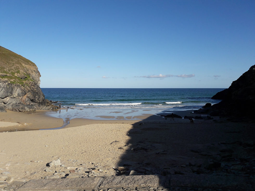
Arriving early this morning, the beach at Chapel Porth had a handful of early beachgoers and was veiled in shadow from the high cliffs that it nestles between.
High cliffs mean a stiff climb out, but actually the path was reasonably gentle and you are rewarded with some fantastic views from the top.
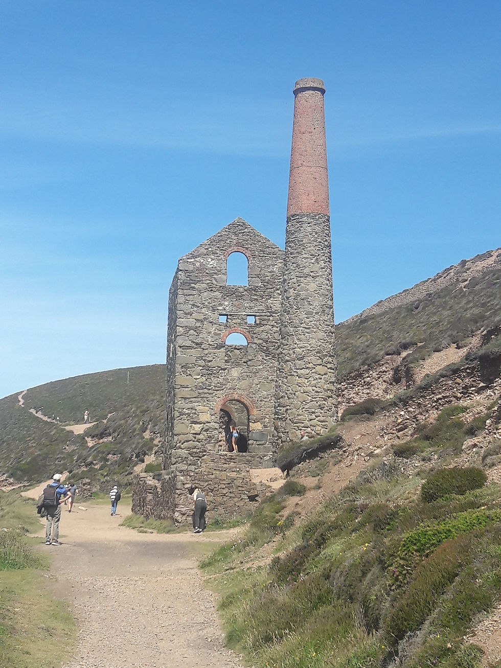
Within half a mile, you arrive at the ruins of Wheal Cotes mine.
Get here early if you want to explore the mine ruins in peace as the engine house is one of the most photographed mines in Cornwall (I took three pictures, one in the morning and two in the afternoon - see the difference!)


A short walk further takes you up the cliffs gently to St. Agnes Head, where once again the views are amazing. Looking West you can see St. Ives Head and looking East you can see Trevose Head and it's lighthouse. The picture below is taken towards St. Ives.

After St. Agnes Head the path starts to drop gently down towards Trevaunance Cove (The village of St. Agnes is 3/4 mile inland) where a sandy beach can be found and a pub sits on the waterfront. There is also a small art gallery and studio, a very pleasant cliff garden cared for by volunteers. Look out for strange art installations!

The path rises steeply out of the Cove, but beware! as soon as you're at the top, you face another steep descent into Trevallas Porth and it's rocky beach. This is another old mine workings, where the ruined mine workings can still be seen and the small cove used to be used to ship out the mine products.
The path leads very steeply out of Trevallas Porth! The picture below (taken from the top of the climb out of Trevallas Porth) shows Trevunance Cove (centre left), St. Agnes Head (centre right) and Trevallas Porth (foreground left).

From here, the path winds around Perranporth airfield, once an RAF base for Spitfires during WWII https://www.cornwallfhs.com/cornwallswarhistory/air-force/raf-perranporth/
There are three WWII bunkers at the St. Agnes end of the airfield that can be explored. Simple concrete entrances disappear into mounds of earth, which once inside open into reinforced concrete chambers (one per bunker), with a small passage way out turning to another doorway on the airfield side of each bunker.


The path continues along the side of the airfield and winds down through old mine workings along the top of the cliffs above Hanover Cove.
I sat here for fifteen minutes enjoying the scenery and watching seagulls float on the wind, the only noise was the gulls calling and single engined aircraft (I assume training flights) circle out to sea and then line up with the runway and make their approach before powering up to climb out and do it all again.
The cliffs of Cigga Head appear to have exposed mine workings in the face of the cliffs and where the cliffs have fallen away, you can occasionally see an animals tunnel, once a route to / from it's burrow, now an exit to a drop of some 250 feet and certain death. I wonder if there is a rabbit in a high visibility vest and a hard hat undertaking a Health & Safety assessment and erecting hazard tape inside the cliff to prevent the stupider rabbits from falling to their death, or is it only Humans that need this sort of over protective regime (there are plenty of signs warning me that cliffs are unstable and I should stay away from the edge!).

I make my way across the disused mining area and over Cigga Head (pictured above) and catch my first glimpse of the long stretch of sands that form Perran Bay and end at the western end with Perranporth.

Walking along the cliffs, the path begins gently down towards Perranporth, passing Perranporth youth hostel which must enjoy the best views of any youth hostel perched, as it is, on the edge of the cliff overlooking Perran Bay.
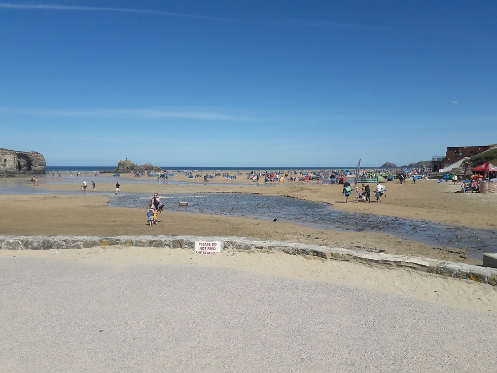
Dropping steeply down the road into Perranporth, your ears are assaulted with all the noise of the British family holiday, kids screaming, kids crying, men shouting at kids, women shouting at men, women shouting at kids! The beach is awash with little encampments nearly surrounded by windbreaks and the smell of BBQ's and fish and chips fills the air.
I take my photo of the beach from the location I walked to last time I came to Perranporth and then hurry back up the road.
Once back onto the cliffs and away from the noise, I retrace my steps and take the time to enjoy nature and watch the paragliders take off from St. Agnes Head. I occasionally take some extra pictures.

Trevaunance Cove (above) from the path leading down to it from direction of Perranporth.

The view East from Newdowns Head (east of St. Agnes Head)
I have now completed 481.9 miles and have 104.2 miles left to walk in the next nine days. Don't forget that I am walking to raise money for the Royal British Legion Dartmoor Branch and all monies raised will go directly to veterans through our welfare fund.
If you'd like to donate please PM me through facebook or E-mail me ( pjuckett@btinternet.com ).


Comments