Day 42 - Lamorna Cove to Porthcurno
- Paul Juckett

- Jul 22, 2020
- 4 min read


It was around this stretch of coast that the flame of my love of Cornwall was ignited way back when I was about ten. The granite rock formations looked enormous to my ten year old self, like building blocks piled on top of each other by the Gods.
Lamorna Cove was my favourite walk (albeit from Mousehole to there) and one that I made many times once I had moved to Exeter with the railway, from where day trips and camping trips were possible. Never did a walk not end in the Lamorna Cove cafe (the cream teas at the Lamorna Cove cafe were unsurpassed) and / or the Lamorna Wink (pub) before I embrked back to Mousehole or my camping pitch.
Well, today was different, for starters there was no cream tea at the cafe. This social distancing stuff means you have to queue to get in and then you can't sit inside!
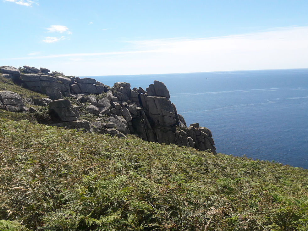
The other difference was the severity of the walk. The first half a mile or so out of Lamorna (towards Porthcurno) is quite extreme and certainly not for the faint hearted! Huge boulders crowd the path, the path crowds the very edge of the cliff and hand holds are often required to ensure motion is forward and not down!

I was the lucky one, carrying only a sandwich cool bag with some water in it, unlike the three gentlemen I met carrying large backpacks who, often found themselves having to stop and take packs off just to squeeze between the boulders.
Once you get through the first half mile or so and up the first steep set of steps (steep, but mercifully shortish) you catch sight of Tater Du lighthouse - a fully automated light that was built in 1965 after a series of tragic shipwrecks.

Around a mile further on (slightly less) you climb gently to Boscawen point, where you are rewarded with a fine view across Paynter's Cove and St. Loy's Cove.
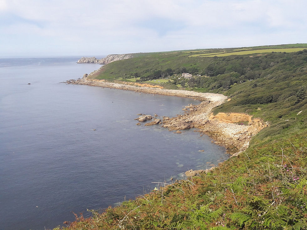
St. Loy's cove is well sheltered and the path drops down through lush areas of vegetation and the path becomes muddy in places as small streams run across and (in places) down it.
Eventually, the path opens onto the waters edge and you have to cross about 50 yards of boulders that totally cover the beach.
The path disappears back into the bottom of a wood which the path winds it's way through, before running along the back of the large property in the centre of the picture. As you leave the boulder strewn beach there is a bench (one of only three on the whole of this walk - after all it's rated strenuous!) which provides shade from the sun and allows one to sit watching vessels cross the horizon, whilst listening to the bird song.

Sitting there, it's almost possible to believe you are on a tropical island somewhere.
Once you have dragged yourself away and climbed out of St. Loy's Cove, you descend back down to Merthen Point, before the path gently climbs back up to the top of the next headland. From there you can see the steep steps down to Porthguarnon and the longer set of steps out!
Once you've made it up the steps, and the ensuing climb past Le Scathe Close, you'll descend on a path that is sometimes gently, sometimes steeply taking you to Penberth Cove. A small fishing fleet still operates from Penberth, with four or five boats usually sitting on the slipway with the winching system still operable to get the boats up out of the water. I witnessed one boat unloading his catch, around 25 good sized Mackerel. Most (if not all) of the six or so cottages around the slipway are Holiday lets.
The final challenge of today's walk was just the climb out of Penberth, where a choice exists between granite steps of varying heights, or a steep scramble up loose shingle slopes alongside the steps (created by people struggling with the steps and walking alongside them!). Once you get to the top,it's about 1 mile of walking along the top of the cliffs to get to Porthcurno. There is a site of an Iron age cliff castle to look at and the famous Logan Rock (if you can identify it - I've never managed it yet!) which, apparently, you can rock by hand on the plinth it sits on despite it's estimated weight of 80 ton!
The path down into Porthcurno passes a couple of WWII pillboxes (one that sits right above the beach) and then descends fairly gently to the rear of the beach.

Porthcurno has good facilities further back up the road from the beach including a pub and the Telegraph museum is a must visit (when it's not closed due to COVID!) https://telegraphmuseum.org/
Today's walk takes me to 493.1 miles walked and just 93 miles to complete over the next nine days (eight of which I will be walking). By July 31st I'll have covered 586.1 miles, ascended a total distance of 73,378 ft and descended a total distance of 73,351 ft (according to Google Maps).
To put those ascents and descents into perspective, if you put Mount Everest, K2 and Mount Kilamanjaro (from the plateau it stands on) on top of each other they'd measure 73,380 ft. Or, if that still doesn't help you picture it dear reader try this, 73,920 ft is 14 miles!
I've done this all, to support the Royal British Legion by raising some money for the Dartmoor Branch to help fill some of the shortfall in our usual fundraising efforts that have had to be cancelled due to COVID-19. Your support is very much appreciated.


Comments